|
Hurricane Wilma - The Strongest
Atlantic Hurricane in Recorded History ! |
|
|
|
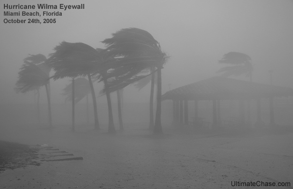
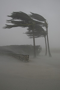
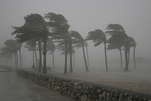
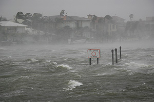
Whiteout
Conditions as the south-eastern eyewall brushes by Miami
Beach |
|
|
|
Ultimate Chase's Location During Hurricane Wilma: Miami
Beach, Florida |
| |
|
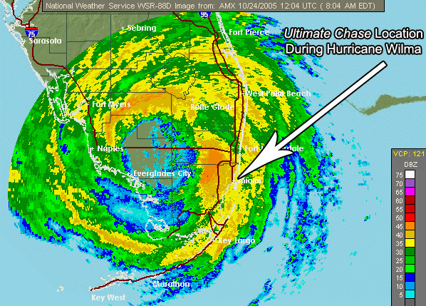
Radar
Image Showing Ultimate Chase's Location: |
|
|
|
Hurricane Wilma Radar Image Courtesy
NWS Miami |
|
|
|
|
|
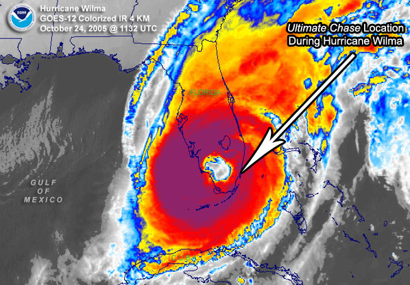
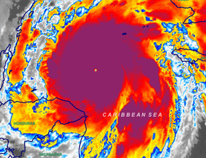
Infrared Satellite Image
Showing Ultimate Chase's Location: |
|
|
|
Hurricane Wilma Infrared Satellite Image Courtesy
NOAA |
|
|
|
|
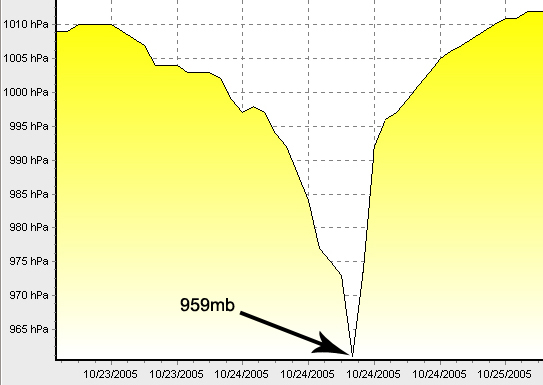
Barometer Graph: |
| |
|
|
|
While in the eye in North
Ft. Lauderdale I Recorded a Pressure of 959mb |
|
|
|
|
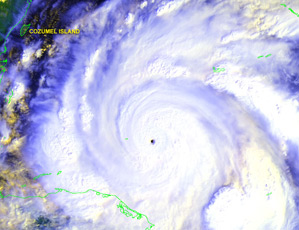
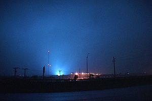
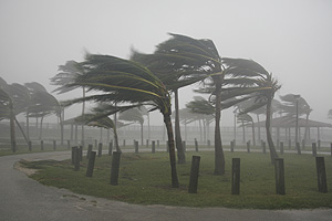
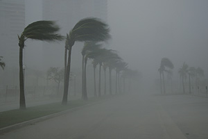
Hurricane Wilma Satellite Images
Below: |
|
|
|
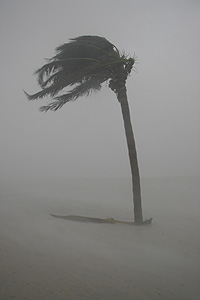
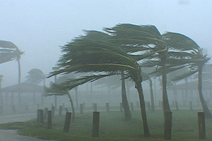
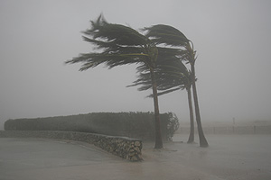
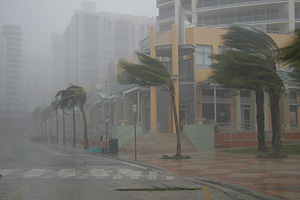
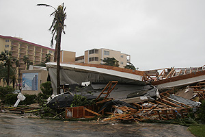
Hurricane Wilma Photos and Video
Stills: |
|
|
|
Hurricane Wilma Chase Account
Below: |
|
|
|
Chase Account:
I tracked
Hurricane Wilma from her very early stages of life in the
Caribbean. Wilma was a historic Hurricane from the very
beginning! After being named, Wilma tied the all-time record
for the most storms in the Atlantic. She didn't stop there,
overnight Wilma went from a Cat-1 Hurricane to a strong
Cat-5 Hurricane, she broke Hurricane Gilberts' pressure of
888mb by morning. Wilma dropped down to an astonishing 882mb
!! Wilma now owns the record for the fastest rate of
intensification and the lowest pressure ever recorded in a
Hurricane in the Atlantic Basin. |
|
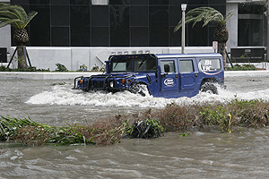
I documented
Wilma's effects in the Upper Florida Keys as she passed by,
then went up to Homestead. In Homestead I documented some
intense winds destroy plastic signs and witnessed dozens of
power flashes throughout the city. I arrived to Miami Beach
an hour before the eyewall came zipping through. Wow ! The
winds were shredding all the palm trees on the beach. I
documented the "Turbulence" effects caused from wind blowing
between high rise buildings. One blast was so strong it
caused a large green dumpster with wheels to start rolling
right for my vehicle. I quickly put the truck in reverse and
hit the gas ! I was able to ease the impact of the dumpster,
but was still clobbered by it causing damage to the front
end of the vehicle. There were large rocks and gravel flying
everywhere coming from the roof tops of high rise buildings.
Visibility was very low from all the blowing sand and I
estimate I saw wind gusts during the peak reaching 120mph. I
decided to head north on A1A through the eyewall and get
into the eye ! |
|
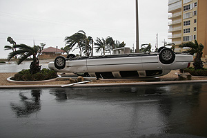
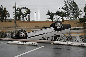
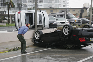
I was now in the
eye of the strongest hurricanes in recorded history ! Of
course she wasn't the same strength as she was just days
earlier, but still a strong Cat-2 hurricane. I recorded a
pressure of 959mb while in the eye. The most memorable event
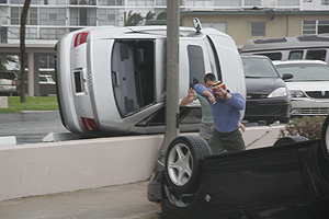
for me in Wilma was documenting all the vehicles that were
flipped over in the Ft. Lauderdale area. I'm not sure what
exactly the wind needs to reach to do this, but it has to be
at least 120mph. I saw more vehicles flipped over in Wilma
than any other Hurricane I have documented. |
|
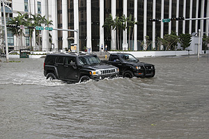
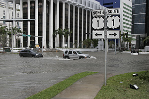
I now decided to
head home to Homestead and see if my roof was still
attached. I head south on US-1 and the traffic slowed way
down in the Brickell area. I stopped to document some of the
damage and noticed there was really thick broken glass
everywhere that was blown out of all the high rise
buildings. This was the first time I have documented a
Hurricane strike on a major city like Miami. I proceeded to
head down US-1, but was detoured because the Miami-Dade
Metro Rail tracks were blown off the platform and were lying
all over US-1 blocking traffic. The metro rail is a major
form of transportation for residents in the South Miami area
and now it was destroyed. I finally got home to find all the
tree's shredded and my roof to be intact, but severely
damaged. Shingles and tar paper was ripped off and power was
gone. Thank God a cold front immediately followed Wilma so
at least I could open the windows and cool off. My biggest
memory after Andrew was sweating for weeks because of no
power and the summertime temperatures and humidity was in
full effect. The 2005 Hurricane Season was exhausting for me
to document and ended with a Hurricane making a direct hit
on my residence. I have learned many lessons from this
season and realize that we as humans can't stop Hurricanes,
so we need to adapt! Stay Strong South Florida !! |
|
|
Photographer, |
|
|
 |
|
|
|
Website copyright notice below: |
|
Hurricane Wilma video stills and photos are
copyrighted and protected under United States and International |
|
copyright laws. These video stills may not be
reproduced in any form, downloaded, stored, or
manipulated |
|
without prior permission from © Ultimate Chase, Inc. |
|
|
|
 |
|
|